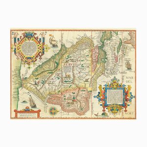
Antique Map of Delineation of All the Coasts of the Entire Southern Part of America by Jan Huyghen Van Linschoten, 1596
£9,600
You are now following British Charts online at Pamono. You can manage alerts in your account settings.
You have unfollowed British Charts online at Pamono.
Antique Map of Delineation of All the Coasts of the Entire Southern Part of America by Jan Huyghen Van Linschoten, 1596
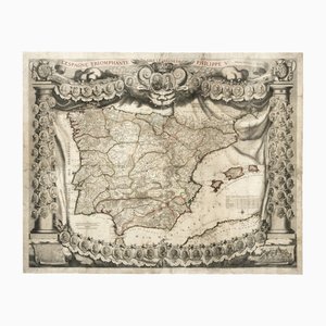
Antique Map of Spain Triumphant Under the Reign of Philip V by Nicolas De Fer, 1704
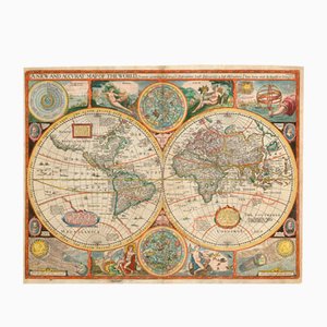
Antique Map of the World after J. Speed, 1651
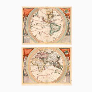
Antique 17th Century World Maps in the style of Coronelli, Set of 2
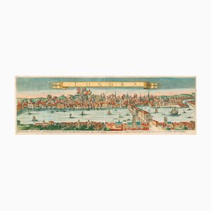
Antique Map of London by Gabriel Gualdo Priorato, 1675
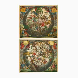
Antique Celestial Hemispheres Charts by Andreas Cellarius for Schenk & Valk, 1708, Set of 2
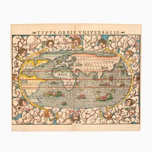
Typus Orbis Universalis Map by Sebastian Munster, 1552
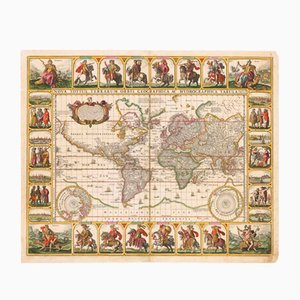
Antique Nova Totius Terrarum Orbis Geographica ac Hydrographica Tabula Claes Map by Janszoon Visscher, 1652
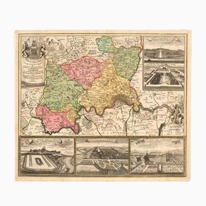
Map of the Environs of London with Inset Views of Royal Palaces by Johann Baptist Homann, 1710
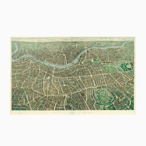
Antique Balloon View of London Map As Seen from Hampstead by John Henry Banks for Banks & Co. & Effingham Wilson, 1851
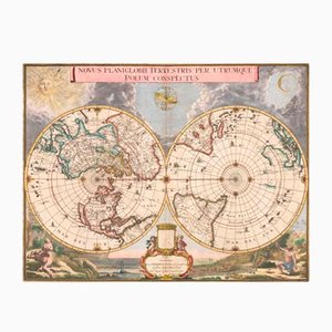
Antique Double Hemisphere Map of the World on a Polar Projection by J. Blaeu, 1695
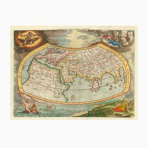
Antique Map of the Ptolemaic World by Gerard Mercator, 1700
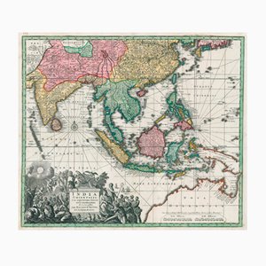
Matthäus Seutter, Antique Map India Orientalis (South East Asia), 1730, Engraving
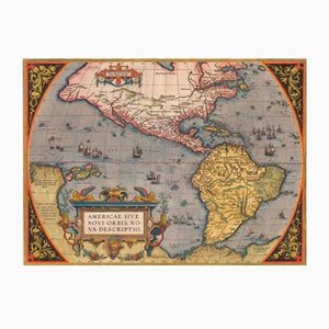
Antique America Sive Novi Orbis Nova Descriptio Map by Abraham Ortelius, 1598
Antique Environs of London Map by Homann Heirs, 1741
Antique Nova et Accuratissima Totius Terrarum Orbis Tabula Map by Johannes Blaeu, 1662
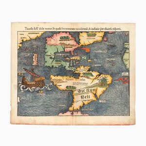
Antique First Map of the Continent of America by Sebastian Munster, 1558
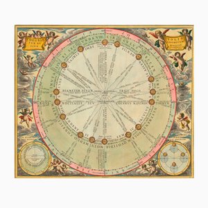
Antique Chart of the Motions of the Sun Through the Skies by Andreas Cellarius for Schenk & Valk, 1708
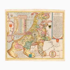
Antique Ecce, Quibus Hispaniar. Rex Philipp. Belgium (The First Leo Belgicus) Map by Michael Eytzinger, 1587
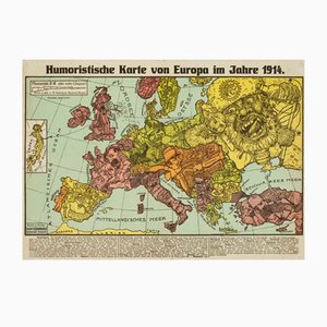
Antique Serio-Comic Map of Europe on the Brink of World War I by Lehmann-Dumont, 1914
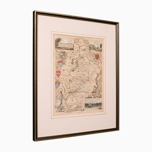
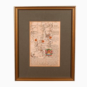
Antique English Framed Nottinghamshire Map
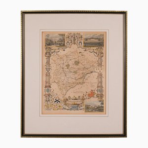
Antique English Victorian County Map
Antique English Framed Leicestershire Map
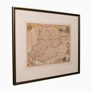
19th Century English Oxfordshire Country Map
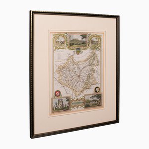
Antique English Rutlandshire County Map, 1860s
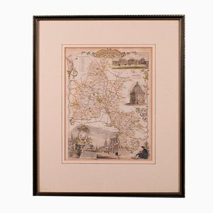
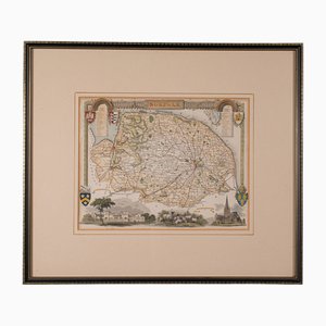
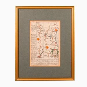
Antique English Framed County Map
Large Scrolled Map of the World by Philips, 1918
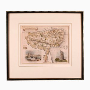
Antique English Isle of Thanet Lithography Map
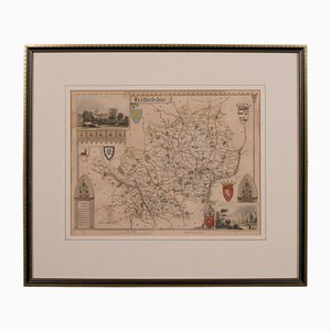
Antique Framed Lithographic Map of Hertfordshire, England
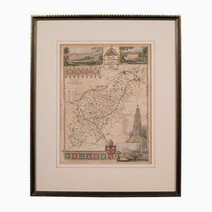
Antique Framed Lithographic Map of Northamptonshire, England, 1860
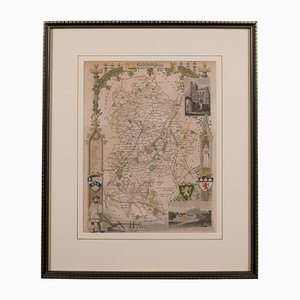
Antique Framed Lithographic Map of Bedfordshire, England
Antique English Chart of Devon
Antique English Coaching Road Map
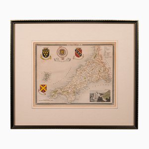
Antique English Lithography Map of Cornwall, 1850s
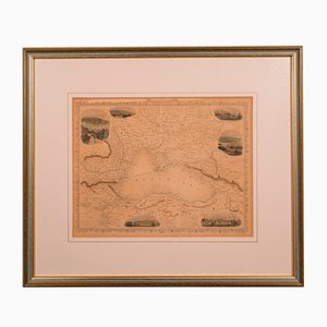
Antique English Lithography Map of Black Sea
Antique English Lithography Map
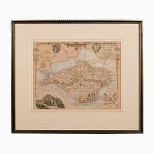
Antique English Lithography Map of Isle of Wight
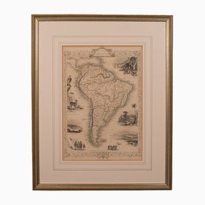
Antique English Lithography Map of South America
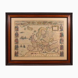
Vintage Reproduction of 17th Century Map of Europe, 1970s
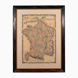
Large Vintage France Map, 1970s
Bone Structure Medical Chart, 1947

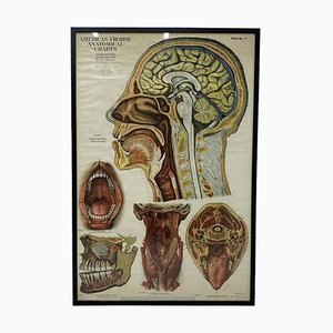
American Frohse Anatomical Chart, 1947
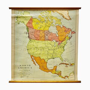
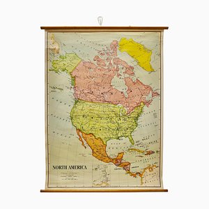
Large University Chart Political Map of North America by Bacon, 1920s
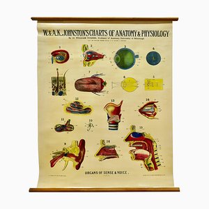
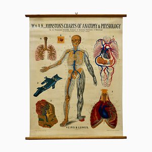
Large University Anatomical Chart of Organs of Sense & Voice by Dr. William Turner, 1920s
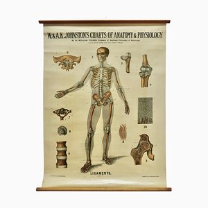
Large University Anatomical Ligamnets Chart by Turner, 1920s
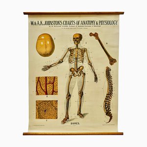
Large University Anatomical Bones Chart by Turner, 1920s
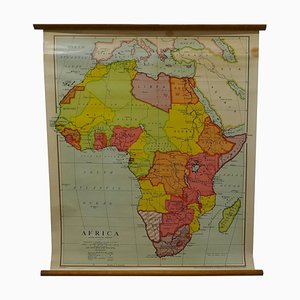
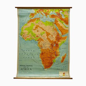
Large University Chart Physical Map of Africa by Bacon, 1920s
Large University Chart Political Map of North America by Bacon, 1920s
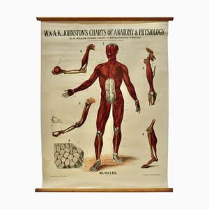
Large University Anatomical Muscles Chart by Turner, 1920s
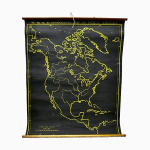
Black University Chart Map of North America, 1920s
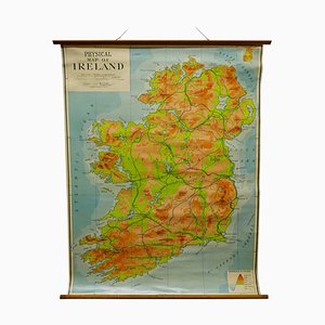
Large University Chart Physical Map of Ireland by Bacon, 1920s
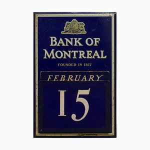
20th Century Tin Plate Perpetual Calendar from Bank of Montreal, 1950s
Large University Anatomical Chart Veins and Lungs by Turner, 1920s
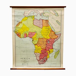
Large University Chart Africa by Bacon, 1920s
Charts of Physical Maps by G.W. Bacon, 1920s
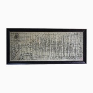
Printed Birds-Eye View of Tudor London
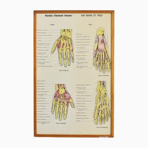
Vintage French Anatomy Chart- Hand & Foot, 1960s
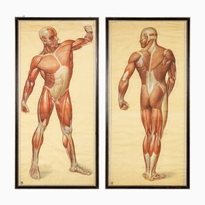
Anatomical Human Muscular Structure Charts by Tanck & Wagelin, 1950, Set of 2
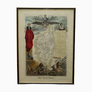
French Hand Watercolour Map of Dept des la Corse, 1856
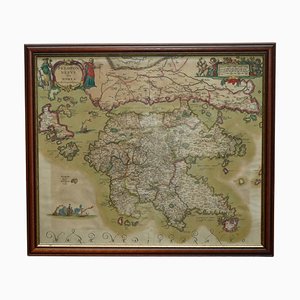
Peloponnesus Sive Morea I Laurenbergio Greece Watercolour Map by Jan Jansson, 1660
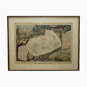
French Hand Watercolour Map of Dept des Hautes Pyrenees, 1856

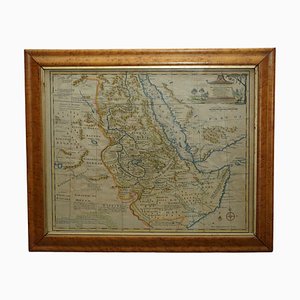
Watercolour Map of East Africa by Eman Bowen, London, 1744
French Hand Watercolour Map of Dept des Hautes Pyrenees, 1856
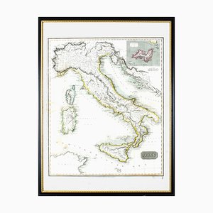
Map of Italy Drawn & Engraved by R. Scott for Thomsons, Edinburgh, 1814
Map of Lancashire
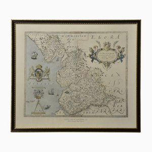
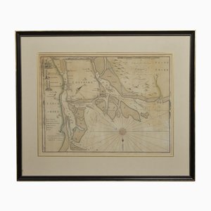
Chart of the Harbour of Liverpool
Northwest Coast and Isle of Man Map

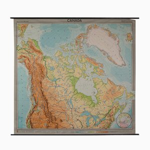
Vintage German Map of Canada
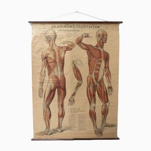
Vintage Swedish Anatomical Medical Wall Hanging
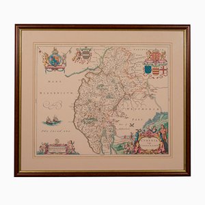
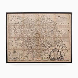
18th Century Map of the County of York by Emanuel Bowen, 1740s
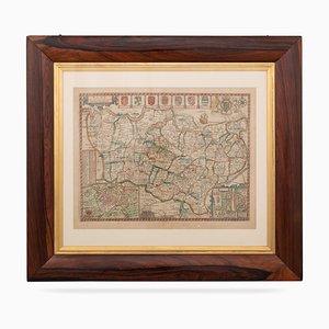
17th Century Map of Kent with Her Cities & Earles Described by John Speed, 1670s
Trending