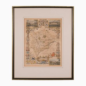
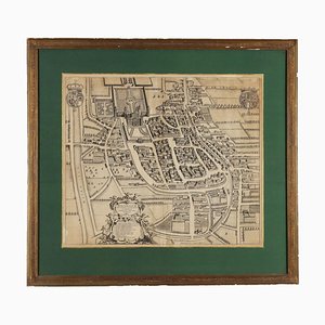
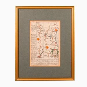
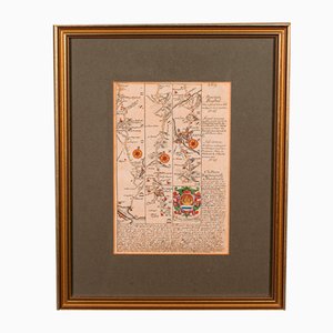
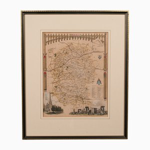
Antique English Rutlandshire County Map, 1860s
£295
You are now following Vintage Charts online at Pamono. You can manage alerts in your account settings.
You have unfollowed Vintage Charts online at Pamono.
Antique English Rutlandshire County Map, 1860s
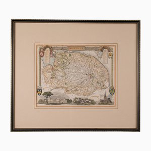
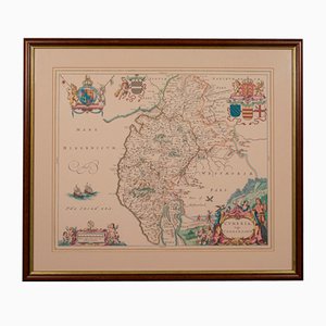
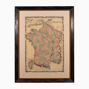
Antique English Framed County Map
Martinique, Original Early Map: Representation la plus nouvelle et exacte De L'Ile Martinique, la premiere des Iles Del' Amerique Antilles...,1741, Original Hand Colored Copperplate Engraving
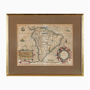
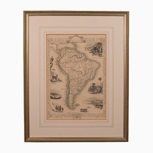
America Meridionalis, Early Map of South America by Gerard Mercator and Jodocus Hondius, 1610, Original Hand Colored Copperplate Engraving
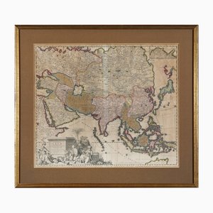
Early Map of Asia: Exactissima Asiae Delineatio in Praecipuas Regiones Original Hand Colored Copperplate Engraving by Carel Allard, 1694
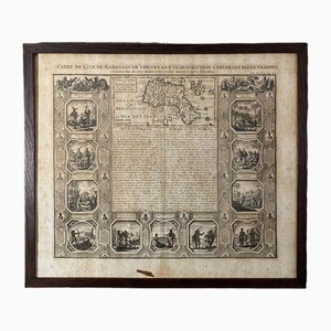
18th Century Map of the Island of Madagascar
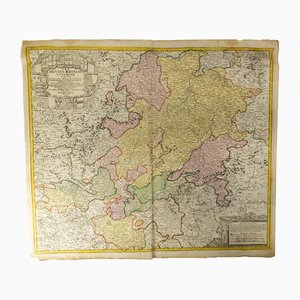
18th Century Hand Colored Engraved Map of Germany S.R.I Circulus Rhenanus
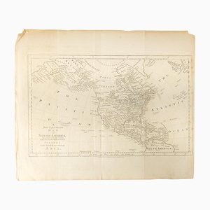
18th Century Map of North America, United States, and Asia by Bowen Thomas and Charles Cooke
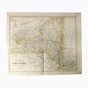
Antique Hand Colored Map of New York State from 1842
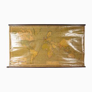
Large Scrolled Map of the World by Philips, 1918
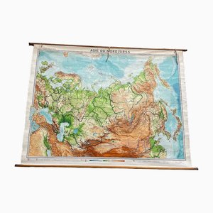
USSR School Chart
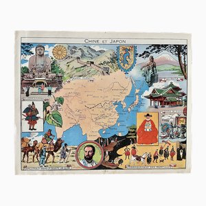
Illustrated Map of China and Japan by Émile-Joseph-Porphyre Pinchon, 1948
Etching with Map of Racconigi, 1726
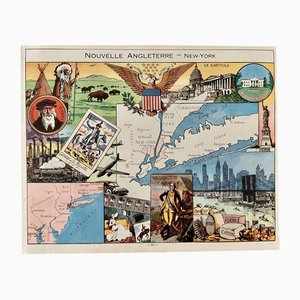
Illustrated Map of New York by Émile-Joseph-Porphyre Pinchon, 1948
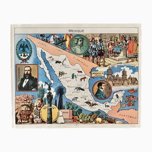
Illustrated Map of Mexico by Émile-Joseph-Porphyre Pinchon, 1948
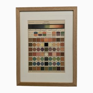
Illustrated Encyclopedia Color Plate, 1900, Color Engraving
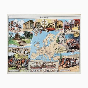
Illustrated Map of Europe by Émile-Joseph-Porphyre Pinchon, 1940s
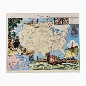
Illustrated Map of the United States by Émile-Joseph-Porphyre Pinchon, 1948
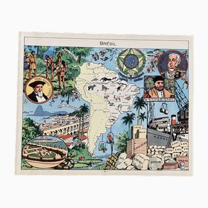
Illustrated Map of Brazil by Émile-Joseph-Porphyre Pinchon, 1948
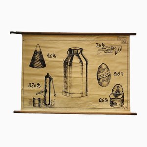
Vintage Educational Board Milk by Georg H. Knickmann, 1940s
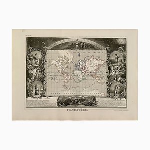
Planisphere World Map, 1849
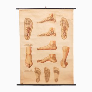
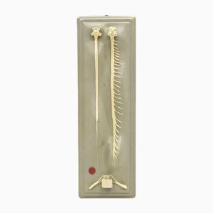
Vintage Pull-Down Medical Wall Chart Illustrating Orthopedics of Foot, 1935
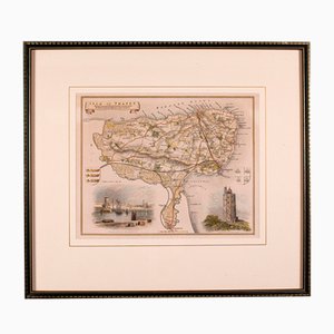
Antique English Isle of Thanet Lithography Map
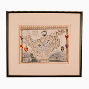
Antique Lithography Map of Cheshire, England
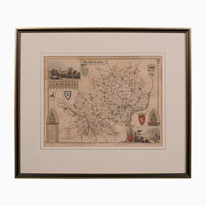
Antique Framed Lithographic Map of Hertfordshire, England
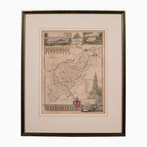
Antique Framed Lithographic Map of Northamptonshire, England, 1860
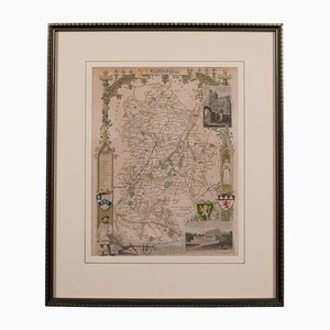
Antique Framed Lithographic Map of Bedfordshire, England
Antique Geographical Maps of the French-German War, Set of 4

Antique English Chart of Devon
Antique English Coaching Road Map
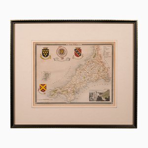
Antique English Lithography Map of Cornwall, 1850s
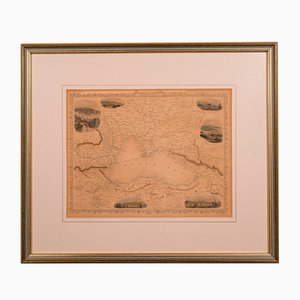
Antique English Lithography Map of Black Sea
Antique English Lithography Map
Antique English Lithography Map of Wiltshire
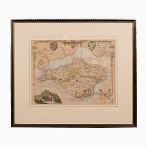
Antique English Lithography Map of Isle of Wight
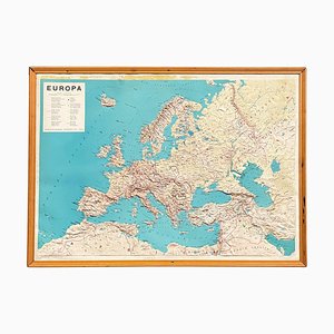
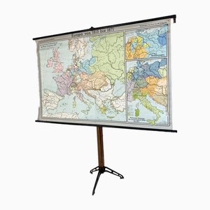
Europe Mural Map, 1970s
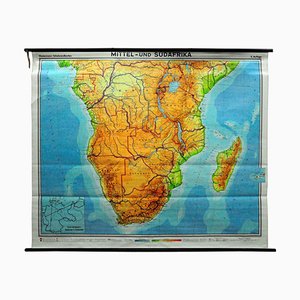
Vintage Map of Central South Africa, 1970s
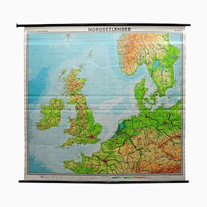
Vintage Mural Map or Wall Chart of North Atlantic, 1970s
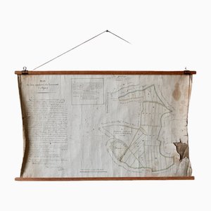
French N°2 Cadastral Plan, 1933
Antique English Lithography Map of South America
Vintage Scientific Educational Panel by Paravia Torino, 1960s
Vintage Scientific Educational Panel by Paravia Torino, 1960s
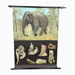
Vintage Wall Chart by Jung, Koch & Quentell for Hagemann, 1970s
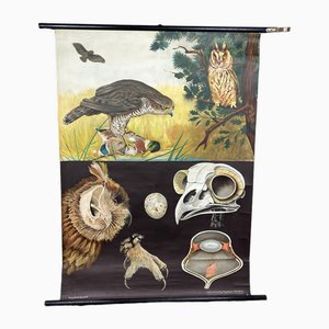
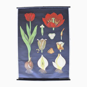
Vintage School Wall Chart
Modern Italian Topographic Geographical Map in Wood Frame of Europe, 1950s-1990s
Vintage School Chart by Young, Koch & Quentell for Hagemann, 1970s
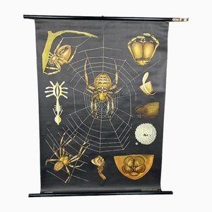
Vintage School Chart by Jung, Koch & Quentell for Hagemann, 1970s
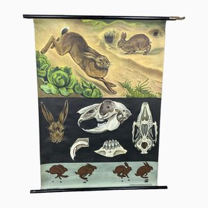
Vintage School Wall Chart by Jung, Koch & Quentell for Hagemann, 1972
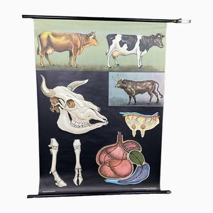
Vintage Wall Chart by Jung, Koch & Quentell for Hagemann, 1970s
Vintage School Wall Chart
Vintage School Wall Chart by Jung, Koch & Quentell for Hagemann, 1970s
Vintage School Wall Chart
Vintage School Wall Chart
Vintage School Wall Chart by Jung, Koch & Quentell for Hagemann, 1970s
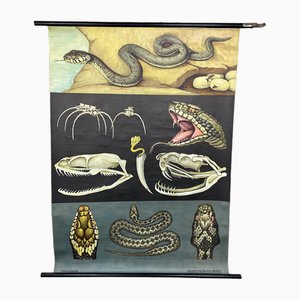
VintageSchool Chart by Jung, Koch & Quentell for Hagemann, 1970s
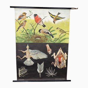
Vintage School Chart by Jung, Koch & Quentell for Hagemann, 1970s
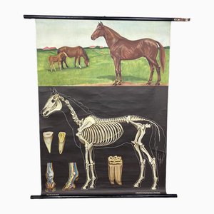
Vintage School Wall Chart by Jung, Koch & Quentell for Hagemann, 1970s
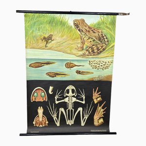
Vintage Wall Chart by Young, Koch & Quentell for Hagemann, 1970s
School Poster by Jung, Koch & Quentell for Hagemann, 1960s
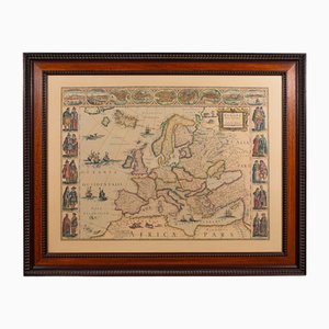
Vintage Reproduction of 17th Century Map of Europe, 1970s
Plan d'Etupes N°3 Chart, 1833
Large Vintage France Map, 1970s
French Plan of 1788, 1825
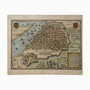
Franz Hogenberg, Map of Antwerp, Etching, Late 16th Century
Vintage School Wall Chart, 1950s
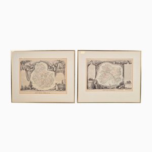
Antique Levasseur La Marne & Cote d'Or Wine Maps, 1852, Set of 2
Old Map of Etupes, 1833
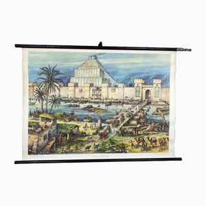
Vintage School Wall Card Print Live in Babylon Posters
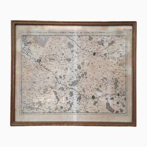
North of France Map, 1710s
Johannes Janssonius, Map of Zeilan, Etching, 1650s
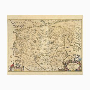
Johannes Janssonius, Map of Macedonia, Etching, 1650s
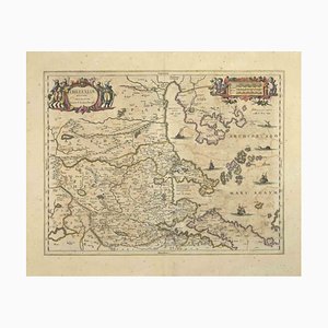
Johannes Janssonius, Thessalia Map, Etching, 1650s
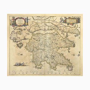
Johannes Janssonius, Peloponnesvs (Greece), Etching, 1650s
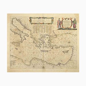
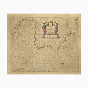
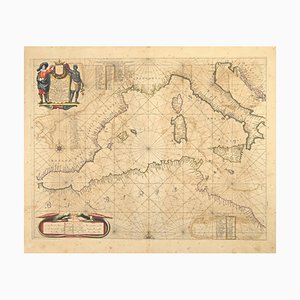
Johannes Janssonius, Maris Mediterranei, Etching, 1650s
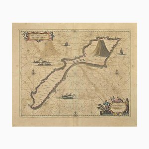
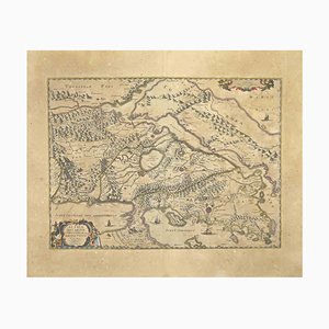
Johannes Janssonius, Map of Dalmatia, Etching, 1650s
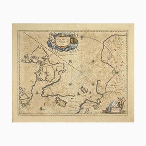
Johannes Janssonius, Map of the Poles, Etching, 1650s
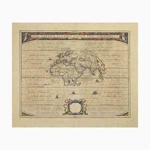
Johannes Janssonius, Orbis Terrarum, Etching, 1650s
Johannes Janssonius, Gulf of Bengal, Etching, 1650s
Bone Structure Medical Chart, 1947

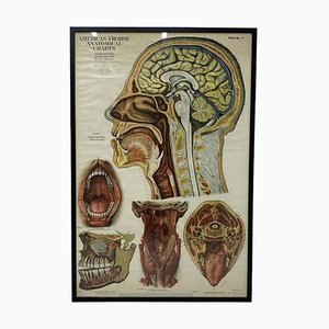
American Frohse Anatomical Chart, 1947
Johannes Janssonius, Antique Map of Gallia, Etching, 1650s
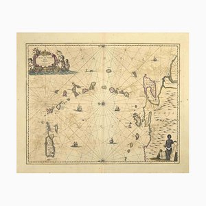
Johannes Janssonius, Oceanus, Etching, 1650s
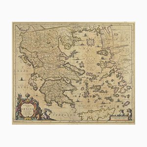
Johannes Janssonius, Antique Map of Greece, Etching, 1650s
Johannes Janssonius, Attica, Etching, 1650s
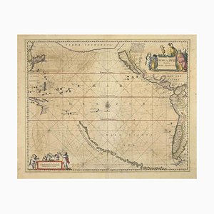
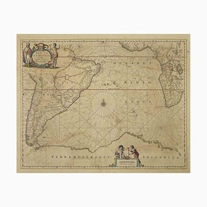
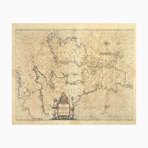
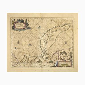
Johannes Janssonius, Antique Map of Mare Pacificum, Etching, 1650s
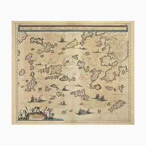
Johannes Janssonius, Antique Map of Archipela Meridionalis, Etching, 1650s
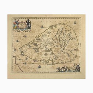
Johannes Janssonius, Antique Map of Mar di Athiopia, Etching, 1650s
Large Vintage Colourful Europe School Map, 1960s
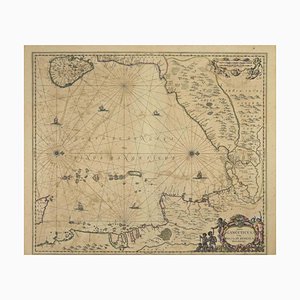
Johannes Janssonius, Freti Canalis, Etching, 1650s
Johannes Janssonius, Nova Zemla, Etching, 1650s
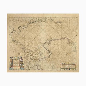
Johannes Janssonius, Oceani Borealis, Etching, 1660s
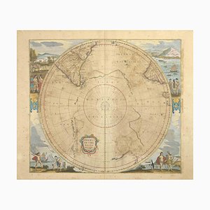
Johannes Janssonius, Polus Antarcticus, Etching, 1650s
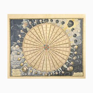
Johannes Janssonius, Anemogra Phica, Etching, 1650s
Johannes Janssonius, Barbarga, Etching, 1650s
Johannes Janssonius, S.Juan de Puerto Rico, Etching, 1650s
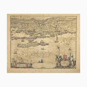
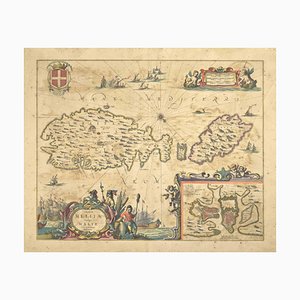
Johannes Janssonius, Mare Mediterra, Neum (Map of Malta), Etching, 1650s
Trending